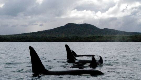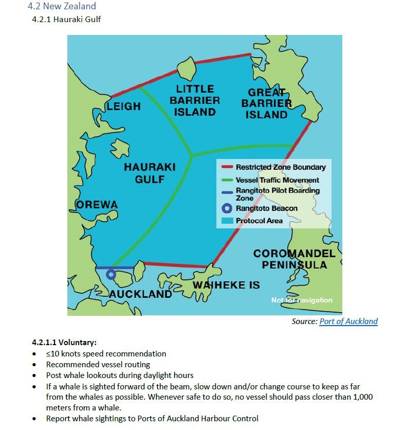
Seafarers seeking to avoid accidental collisions between their vessels and whales, can now turn to a new resource, called a whale chart, which offers critical coordinates for navigating away from mammal harm.
The new resource was launched shortly before reports of pods of orcas seemingly attacking vessels in Spain and Portugal. Up to 47 reports of interactions with orcas - the largest member of the dolphin family – had been reported in the waters of Spain and Portugal by November 2023, although not all ended in boat attacks. One incident saw a pod of orcas sink a sailing yacht after pummelling it for almost an hour on Halloween in the Strait of Gibraltar.
The World Shipping Council (WSC) launched the free and regularly-updated WSC Whale Chart navigational aid at the beginning of November 2023 at an international whale protection workshop.
President and CEO of the WSC John Butler said: 'With the WSC Whale Chart, seafarers will, for the first time, have a comprehensive global resource offering critical navigational coordinates and concise graphics to identify routing measures and areas subject to static speed restrictions designed to protect whales and other cetaceans.
'We hope that by compiling this unique navigational aid, keeping it updated and making it available for free to all navigators, we can help reduce ship strikes and safeguard endangered whale populations across the globe.'

Whales inhabit the world's oceans and many spend considerable time at the surface. For these reasons whales are especially vulnerable to injury by vessel traffic, and experience shows that separating ships and whales is the most effective way to limit ship strikes.
In areas where separation is not possible, speed reductions can help mitigate the risk. Hence, there are numerous international, regional, national and local regulations and recommendations addressing areas to be avoided, routing measures, and speed restrictions for seafarers to keep track of as they navigate the globe.
WSC members are container and roll-on-roll off carriers, with vessels in constant transit across the oceans.
The chart includes coordinates, speed restrictions and sighting protocols for cetacean-sensitive areas of the US, Central and South America, Asia, the Middle East and the Mediterranean Sea (such as the Straits of Gibraltar and the Hellenic trench) as well as sanctuary zones off Canada, Australia and New Zealand.
- download the WSC Whale Chart

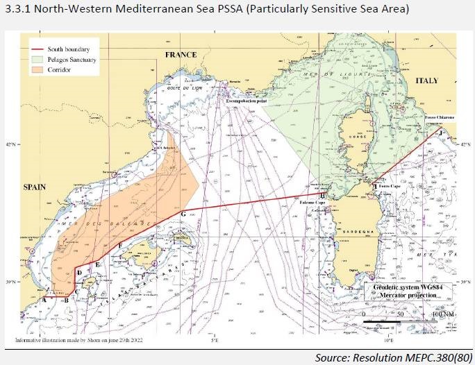
IMO speed restrictions in the North-West Mediterranean Sea
The IMO has adopted a new voluntary speed restriction scheme in the North-West Mediterranean Sea to protect local whale populations. This area is also marked on the global whale chart.
The IMO's recent designation of the North-Western Mediterranean Sea as a particularly sensitive sea area (PSSA) is the latest addition to the list of initiatives from governments to protect whales from international shipping.
The North-Western Mediterranean Sea PSSA is located between the coastlines of France, Italy, Monaco and Spain and its precise description and location, including navigational coordinates, originated in IMO Resolution MEPC.380(80).
Tags
More articles
Treated like 'freaks': Seafarers latest happiness index shows the continued long reach of coronavirus
The erosion of shore leave, possibly exacerbated by the COVID-19 pandemic, has led to services ashore becoming less empathetic and less tailored to the needs of seafarers, according to the latest Seafarers' Happiness Index.
European waterways: security threat warnings issued for navigation on the Danube
The president of the Danube Commission (DC), Liubov Nepop, has condemned a Russian attack on the Danube infrastructure in Odesa port as a threat to security of navigation on the Danube.
Nautilus speaks out for seafarer safety at major IMO/ILO conference
Nautilus general secretary Mark Dickinson has called on governments, shipowners and maritime unions to form a 'coalition of the willing' to learn the lessons of Covid-19 and deliver a new social contract for seafarers
Safety at sea pledge reaffirmed at Nautilus general meeting
Nautilus will spend the next four years working to address potential hazards to seafarers and the public, following a vote of members at the Union's General Meeting in Liverpool.
